
Click on photos to enlarge.


wildlife,places,walks,cycling,photos and thoughts
Click on photos to enlarge.
Found this place by browsing my Outdoors GPS OS Maps app. Its a fab app – all your maps in one place with gps so you can see exactly where you are and you can build your own routes for walking or cycling or………..? I plan most of my walks using it, as you can check out points of interest, work out how many hills you are going to have to go up and down, and their gradient! One of the best things is the GPS, which I found to be pretty accurate, as knowing where you are on the map is not always so easy. You can use it offline too, which is a great plus. It gets some rather bad reviews on the Google Play store but Ive not had any problems. You have to pay for offline use – think its £19. Another one which gets very good reviews and does lots of extra stuff is View Ranger. I use Komoot for cycling, although map My Ride is good too, but they don’t have so much info on them.
Anyway, on to Wharram Percy. All the info about it is on boards, so click on the photos to read them.


Its amazing to walk where people lived in the middle ages and before. Below you can see how the village would have looked.

The the landowners evicted the villages so that they could use the land for sheep farming. Unbelievable!!!! Imagine what that must have been like.


Above you have what was called the improvement farm built 18thC. Click on the info board on the first photo to see info.


Above are a few images of the church first built in 10thC . The info board shows the various phases of building. It was still used by local villages even when Wharram was deserted.
Next we have the churchyard. The gravestone still standing are all from 18thC but 700 medieval skeleton have been found, which have revealed some very interesting evidence of how the villagers lived. Click the photos to read.


Next up is the mill pond.


Imprints are left in the ground of medieval Long Houses and Farmsteads and a Manor House.


I found this place fascinating and very atmospheric. There’s Wharram Abbey just down the road too.

The walk starts from the gate onto the golf course at Holt Farm on Holt Lane. Make your way straight on down the hill bearing right towards Breary Nature Reserve and Pauls Pond. Make your way leftwards around the pond going straight on into the woods. A little way in you will see a gate on the left, by an information board, turn through this gate towards some converted farm buildings. Go through the yard and over the cattle grid. Where the road bends to the left, take the path on the right towards the direction of Bramhope. Deer are often spotted here. Go over the stile at the bottom into a field (beware the cattle if they’re there) and carry straight forward past the rugby club on your right. You will come out onto The Sycamores.


Turn right up the Sycamores to the end of the road and cross over the A660 and climb over the stile and follow the way markers.


Breary Grange farm was established by the monks of Kirkstall Abbey who owned most of the land around Cookridge, Adel, Bramhope, Pool, Arthington, Horsforth and further afield. Kirkstall Abbey must have been very, very well off. In the last photo you can see the farm at East Breary. Both East and West Breary were townships, each had a farm but no village.
Eventually you reach Black Hill Road where you take a left. Shortly you will see Bank Top Farm, here take a footpath on the left, part of the Ebor Way. On your right as you walk through the fields is Blackhill Quarry . The main source of Bramley Fall stone is here, operated by Mone Bros Ltd since 1979. But the quarry has been worked for a lot longer than that. In 2011, four thousand tonnes of Bramley Fall sandstone, sourced at Blackhill, was used to widen the Blackfriars bridge across the Thames, when the new railway station was being constructed in London.
Follow the way markers which will lead you to Breary Lane East. There are some amazing houses down here, but their view across country has been blighted by the building site of Miller Homes.


There are a number of older cottages too. At the junction at the bottom of the road take a right onto Creskeld Lane then left onto Creskeld Drive. Now I have to warn you that the next mile or so is in suburbia, but not any old suburbia because this is high end Bramhope and I just love looking at all these beautifully styled houses. You’d need a £1000000 or so to buy one and employ a cleaner! but they are all so individual and beautifully designed and the views over the valley are to die for. As you near the bottom of the hill there is a path off to your right opposite Hall Rise on the left. This takes you through woods towards the North entrance of the Bramhope tunnel and a where Bramhope Corn Mill used to be, if you would like a short detour.


The solarium that you see in someones garden is a listed building and was in the grounds of Bramhope Hall. Keep going up Hall Drive, which is a quite a large hill. At the top you meet the A660 again. Turn left and come to the Puritan Chapel.


Bramhope Chapel is gable on to the Leeds Otley Road, its principal elevation facing south, with a small enclosed sanctuary at the east altar end, and a bell cote surmounting its west gable. It was formerly in the grounds of Bramhope Hall, which has been demolished, and now stands close to the edge of the hotel car park. It is built of coursed squared sandstone and has a stone slate roof.
The chapel dates from 1649, and is a single storey Puritan Chapel having a virtually symmetrical 6 bay elevation with round headed doorways in bays 2 and 5, the remaining bays have 3 light windows except for the 1st bay that has a two light window, all with chamfered mullions set in double chamfered surrounds with square heads (Thornborrow, 2004).
Principal structural alterations date from the early 19th century, when the walls and roof structure were raised by a few feet and a flat plaster ceiling (now removed) was inserted. After a period of neglect and severe storm damage in 1962 it was placed in the care of the local authority and thoroughly repaired (Stell, 1994). It was built by Robert Dyneley of Bramhope Hall who was a devout Puritan.


The second photo shows some graves of the inhabitants of Bramhope Hall over the years. The fourth photo is interesting as it states that Francis Walker and his wife Susannah and all descendants bearing the name of Walker are interred in a straight line facing Northwards. The next photo is of Charlotte Darwin wife of Francis Darwin(Rhodes) of Creskeld. He assumed her surname and arms in 1850 upon inheritance of Elston Hall from Robert Alvey Darwin[4] and they took up residence at Creskeld Hall.[5] The estate thus came into the ownership of the Rhodes family, who had been in Wharfedale for many centuries.
The next one is Sarah Ellen Rhodes nee Sheepshanks. We met the Sheepshanks family in Arthington from Arthington Hall. The last is a memorial to William Rhodes who died in 1869.
I have found there are so many connections with families within the West Riding areas.
The Hall (demolished in the 1960s) is thought to have occupied the site of an earlier medieval hall, and is located underneath what is now the hotel, off Leeds Road. The Hall is thought to have incorporated building phases from at least the 16th century, and is known to have been owned by the Dyneley family from 1546 until 1767. Between the 17th and 19th centuries the Hall had several owners and was structurally altered several times.
The earliest known settlement in the area was a British camp established off Moor Road. The Romans built a road through the area from Adel to Ilkley, traces of which remain in a field near Leeds Bradford Airport.[2]
Bramhope is mentioned in the Domesday Book as the manor of an Saxon thane, Uchill. In 1095 the manor passed to Percy family, and in 1165 was sold to Ralph de Bramhope. In the 13th century the monasteries owned much of the land and had granges where sheep were grazed. The monks used tracks, such as Scotland Lane and Staircase Lane, as they travelled from their outlying granges to Kirkstall Abbey.[2]
The village had a small population until the 20th century. The Black Death of 1348-9 reduced the number of adults to 34, but this gradually increased to about 400 in 1900. Now it is in the region of 4,500.[2] Water was drawn from private wells or the town well at the foot of Northgate (now Church Hill). The town well was restored in 1991 by the Bramhope History Group, and is located opposite St Giles Church.[2] The plaque says that the well was exposed in 1991, so perhaps it had been lost for some time.[3]
If you come out from the chapel turn left, walk past the hotel entrance and just past there you will see the information board about the well and the hall pictured below.


Back to the walk. Cross over the road to St. Giles church – theres not a lot of interest to the church, but opposite, the other side of Church Hill is Old Manor Farm circa 17th.


Walk up the hill past some old cottages on your left and another listed building on the right, then reach the Cross and the Fox and Hounds pub, which has been here since 1728. Bramhope has two distinct characters. At the cross-roads of Eastgate and Church Hill is the historic centre of the once nucleated settlement. The second came following the construction of the Leeds to Otley turnpike road in the mid 19th century. From this time Bramhope developed into a suburban settlement, particularly from the 1930s onwards.


The church Hill and Eastgate routes were known to have been bridleways in the medieval period and the sunken nature of parts of them suggest that they are ancient landscape features.
Most of the standing buildings centred around the crossroads near Church Hill date to the 17th and 18th centuries, and reflect the largely rural and agricultural past of Bramhope village. They are typical Yorkshire millstone grit buildings, with little ornamentation, and have stone or slate roofs. Many of the buildings are Grade II Listed former farmhouses (such as ‘Old Manor Farm’ (1691), Bramhope Manor (originally constructed in the 16th century but rebuilt in 1803), 1 Church Hill (late-17th century) and ‘The Hollies’ (mid-18th century)), however there are also indications of local industrial production at ‘The Smithy’ (dated 1687) and ‘Weavers Cottage’ (1709).
So turn left and walk down Eastgate and you will see the weavers cottage on your right. There are then a number of cottages, then some houses of 17th/18th century. And then the Methodist Church which is the biggest church in Bramhope. Methodism in Bramhope has a long history, the first documentary evidence of Methodist preaching in the village dating back to 1777. Services took place in cottages and barns for many years until the first chapel was built in 1837. This building eventually became too small so the present church was built to replace it in 1896.


After the church there are a few other buildings of interest but I haven’t been able to find any information about them.


The first house above has a date of 1758 above the door. Go down a lane by the side of the Knoll Playground ( see info in photo below).

At the end of the path cross straight over the road and follow the path through the woods. As you come to the end you will come across another railway tunnel shaft.


So now you meet Moor Road. Cross over and you will see a stile to your left which you clamber over and check out the sighting tower which I have mentioned before ( Bramhope Tunnel Update Post). See map below and finish off walk this way following post backwards.

There will be another post on Old Bramhope soon. Old Bramhope is up Old Lane past the Robert Craven Memorial Hall. I hope to do some detective work on the children’s home there.
Bramhope is one of Leeds many conservation areas believe it or not! Miller Homes have been allowed to build on what must have been Green Belt in Bramhope, so I don’t know what conservation status actually means!


Its been a long time since I visited Brimham Rocks. The area is owned by the National Trust.
A large mountain range stood nearby over 400 million years ago – erosion eventually created a huge river delta, the sands of which eventually created the rocks we see today. Ice, rain and wind have created some wonderful weird and wonderful shapes. The area also covers woods and moorland, with plenty of wildlife to spot with a bit of patience.
Theres a hut seeing drinks, cakes, snacks and sandwiches – hot and cold. Theres also and information centre.
Beware the cost of parking though! Unless you’re a National Trust member, you will pay £6 for four hours.
Here are some photos I just snapped. Click on each photo to enlarge – they look much better.


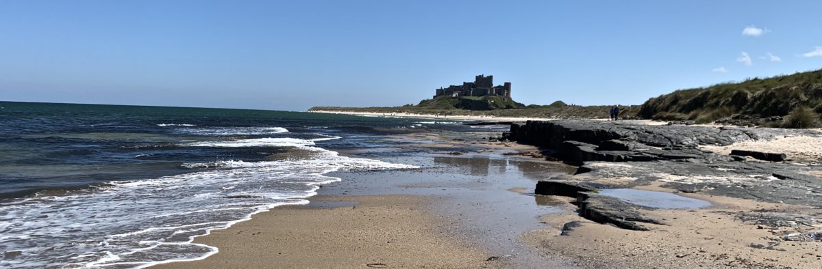
I often travel over to Gisburn from Leeds to meet up with a couple of my Lancashire friends for lunch at the White Bull. I love the journey – the A59 is one of my favourite rides. Just north of Addingham, I’ve often noticed a large hill on the right which looked like a good place to climb up for some great views and made it my ambition to find out what it was called and make it to the top one day, which is just what I did last weekend.

Above is the view of the Beacon from Addingham where we set off from. We parked near St Peters church, which is well worth a tiny detour to see. It seems as though it has been a place of worship since Anglo Saxon times. Click on the photo of the information board pictured below and enlarge it to read about it.


Theres an interesting board about Addingham too. So back over the tiny bridge onto the road through Addingham for a short while, we meet the Dales Way and go down some steps to a bridge across the River Wharfe.


Along a path beside a small stream and through a gate by a farm onto another country road. We walked up the road a short way passing one footpath and joined the next one on the right over a gate and crossed a very muddy field. You then hit an incredibly narrow bridleway. Fine to walk single file but how the hell a horse gets through I will never know and thank goodness we didn’t meet one coming the other way!! This eventually meet another country road and we turned left walking for a few hundred feet until we climbed over a small stillest over a wall by a large house and through some woods, coming out onto another very boggy field. We then hit the road which comes up from Beamsley to the bottom of the Beacon.
From there we climbed to the top to these magnificent views.


Here are some plaques on the trig point. One commemorating the crew of a Lancaster bomber that crashed on the slopes of the Beacon in 1945 and the other about the Beacon where bronze age burial mounds have been found. Again click on the photos and enlarge them to read the info.


This walk joins up with the previous walk in Nidderdale. Again on part of the Nidderdale Way. Although only 4 and a half miles there’s a pretty strenuous climb between 3 and 4. Be good to try and join the two together but don’t think I’m quite ready for that yet.
Had a fabulous day out at Howe Stean Gorge near Pately Bridge in Nidderdale, N. Yorkshire, easier this month. The cafe hangs out over the gorge and has glass in the floor so you can gaze down at the gorge below, whilst drinking your coffee.
Theres activities that you can book but we just did the gorge walk which was great fun. Its narrow and can be slippery – theres ropes to help you – theres caves and tunnels – you have to be reasonably fit. The photos below help tell the story. The scratch marks you can see on the rocks on one of the photos are made by otters-unfortunately we didn’t see any.
https://www.howstean.co.uk/families/visitor-attractions/


On Wednesday I visited Coldstones Cut near Pately Bridge Yorkshire. What a very interesting place. Its Yorkshires biggest and highest public artwork.


It was so windy and wild and quite exhilarating. Below are the explanation boards and a link to the website.


Had a lovely afternoon at Fountains Abbey, near Ripon. Really nice cafe/restaurant. Typical National Trust shop and entry price! I thought £13.50 was rather steep for entry to say the least. Very keen to get you to join the Trust but I will not ever do so whilst they allow FOX HUNTING on their land. It disgusts me!
In 1132, 13 monks came here to start a simpler life. Over 400 years later, when Henry VIII demanded the closure of the Abbey, the monks left behind the most complete Cistercian abbey remains in the country.


The abbey was founded in 1132 by 13 Benedictine monks from St Mary’s in York. They’d grown fed up of the extravagant and rowdy way that the monks lived in York and so they escaped seeking to live a devout and simple lifestyle elsewhere. This was how they came to Fountains.
By the time three years had passed the monks had become settled into their new way of life and had been admitted to the austere Cistercian Order and with that came an important development – the introduction of the Cistercian system of lay brothers.


The lay brothers (what we would now call labourer) relieved the monks from routine jobs, giving them more time to dedicate to God rather than farming the land to get by. It was because of the help of the lay brothers that Fountains became so wealthy through wool production, lead mining, cattle rearing, horse breeding and stone quarrying.


Bad harvests hit the monks hard and they also had to deal with raids from the Scots throughout the 14th-century, which led to economic collapse. This was only made worse by the Black Death which struck the country in 1348.
Despite its financial problems, the Abbey remained important. The abbacy of Marmaduke Huby (1495 – 1526) marked a period of revival and the great tower built by Huby symbolises his hope for the Abbey’s future.


The Abbey was abruptly closed down in 1539 in the Dissolution of the Monasteries ordered by Henry VIII, and the abbot, prior and monks were sent away with pensions.


